

-
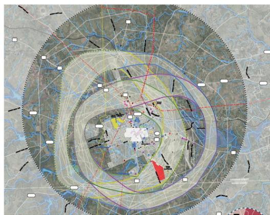 Public input offered this summer has been used by the Texas Department of Transportation to develop four possible routes around the city to relieve traffic through the middle of Lampasas. The routes are color-coded and can be viewed on the TxDOT website. The outermost circle in this map, represented by the broken black-white line, outlines the study area considered for a new traffic route. TXDOT STUDY MAP
Last week, representatives of the Texas Department of Transportation were in Lampasas for a second public hearing on the potential relief route around the town that would connect U.S. Highways 190, 281 and 183.
Approximately 50 people gathered at Lampasas Middle School to hear a presentation on why the relief route could be necessary and where the route could be constructed.
Both before and…