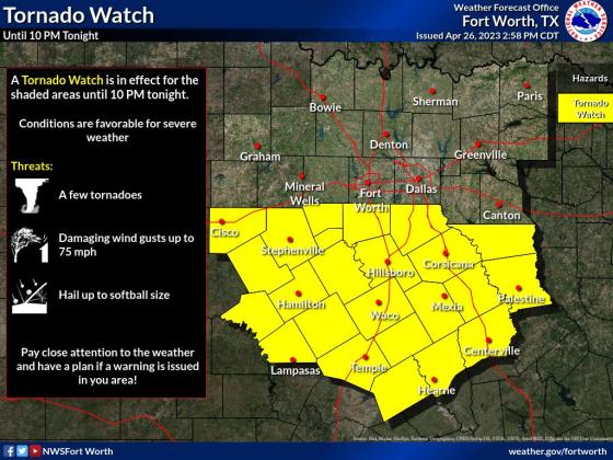
Batten down the hatches, the National Weather Service has issued a tornado watch for Lampasas and surrounding counties this afternoon.
The watch was issued at 2:50 p.m. this afternoon and remains in effect until 10 p.m. for Lampasas, Bell, Burnet, Coryell, Hamilton, and a number of other central Texas counties.
In a hazardous weather outlook issued thirty minutes prior, National Weather Service meteorologists said the severe weather threat exists south of Interstate 20.
“Storms will continue across North and Central Texas today. The greatest severe weather threat has shifted south of the I-20 corridor but a few severe storms cannot be ruled out along/north of I-20. Large hail will be the most widespread threat with damaging winds and tornadoes possible south of I-20,” the statement read.
According to the NWS daily forecast, chance of precipitation is 30 percent this afternoon, rising to 70 percent this evening. The greatest chance of severe storms for Lampasas County will occur overnight before 1 a.m. Rainfall amounts are expected at a tenth to a quarter of an inch, with great rainfall possible during severe storm activity.
Flash flooding is also a concern, officials said, especially across eastern Central Texas and East Texas.
Meteorologists predict more stormy weather Thursday and Friday as well.
“An isolated storm or two will be possible Thursday morning across eastern portions of North and Central Texas. Cannot rule out small hail with the strongest storms,” officials said. Another cold front arrives late Friday with scattered thunderstorms possible along and ahead of the front. Some severe weather will be possible, mainly across Central Texas with hail and damaging winds as the main threats.”


