

-
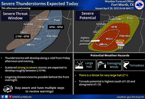 The National Weather Service provided an infographic showing higher levels of storm activity in the Lampasas area between 4-9 p.m.
Lampasas County is likely to see more stormy weather this afternoon.
At 5:30 a.m. Friday morning, the National Weather Service issued a hazardous weather outlook for Lampasas, Bell, Coryell, Hamilton and surrounding counties.
“Strong to severe thunderstorms are expected this afternoon and evening across much of North and Central Texas as a cold front moves across the region. Large hail and damaging winds will be the main threats with these storms, but a few tornadoes will also be possible,” NWS meteorologists said. “Scattered thunderstorms are expected tonight behind the main line of storms. Lightning will be the primary threat.”
The Lampasas area will likely see the most severe storm activity between 4 p.m. and 9 p.m. Tornadic activity is most likely west of Interstate 35, NWS officials said.
According to the daily forecast, Lampasas has a 50 percent chance of showers and thunderstorms after 1 p.m. South winds of 15 to 20 mph could include gusts as high as 30 mph. Rainfall amounts of less than a tenth of an inch are expected, but higher amounts possible in thunderstorms.