


Update: At 6:14 p.m., the National Weather Service issued a severe thunderstorm warning for the area to last until 7:15 p.m.
Severe storms are expected this afternoon, accompanying a front moving southeast across the region.
National Weather Service officials issued a hazardous weather warning for Lampasas, Coryell, Hamilton and surrounding counties at 3:32 a.m. Thursday, anticipating severe storms from 4-8 p.m.
“Scattered storms may develop during the day, ahead of an approaching cold front,” officials stated on the NWS website. “Some of these storms could become severe. The main event still appears to be a linear complex of storms along the rapidly advancing front. Damaging wind gusts, tornadoes and large hail are all possible hazards.”
According to the hazardous weather outlook, “The greatest risk for severe weather will exist along and east of Highway 281 during the day, shifting east of the I-35 corridor during the evening hours.”
This line of storms will push east, impacting East Texas Thursday evening when the greatest threat for severe weather will occur.
“Stay weather aware and have multiple, reliable methods to receive warnings on Thursday. Know where to shelter before a warning is issued!” NWS officials said.
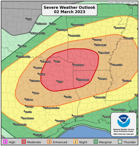
As of the Wednesday, the National Oceanic and Atmospheric Administration registered the Lampasas area with a five percent chance of tornadic activity, a 15 percent chance of thunderstorm winds with gusts of 58 mph or higher, and a 15 percent chance of large hail.
TORNADO SAFETY TIPS
NWS meteorologists offer these tips on tornado safety:
• Move to an interior room on the lowest floor of your home, and stay away from windows.
• If possible, leave mobile homes before a severe weather event begins to shelter with friends or family in a permanent building.
• Those driving when a warning is issued should never stop under bridges or overpasses, which would put a motorist at a greater risk of serious injury from flying debris. Instead, get off the road. The best option is to drive to a designated shelter, basement or safe room.
WEEKEND FORECAST
Windy conditions will continue Friday, especially during the morning hours, with 35 to 45 mph gusts possible. While a sunny weekend with highs in the upper 70s is expected, stormy conditions may return by Wednesday.
“Thunderstorm chances return by the middle of next week with the arrival of a strong cold front and upper-level disturbance,” the NWS outlook read.
