
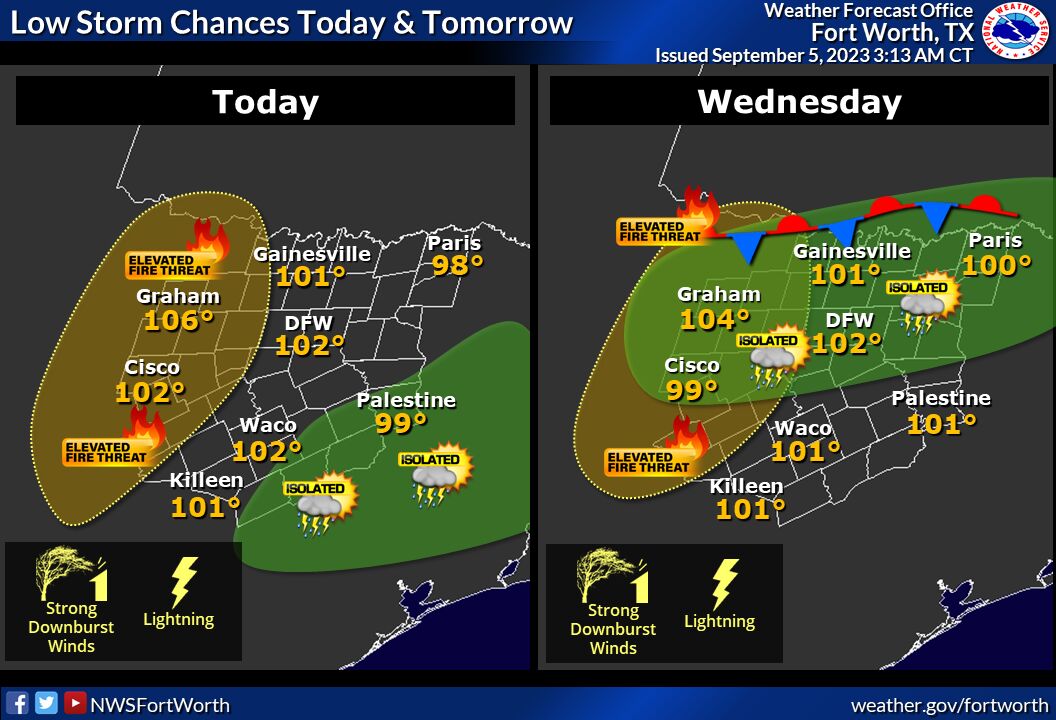
A heat advisory has been issued for Lampasas County for the next two days.
At 1:18 a.m. Tuesday, the National Weather Service issued a heat advisory, effective from noon Tuesday to 9 p.m. Wednesday. Heat values of up to 109 degrees are expected.
The advisory is in effect for Lampasas, Bell, Coryell, McLennan and surrounding counties. It was accompanied by a hazardous weather outlook issued for North and Central Texas at 6:21 a.m. An elevated fire threat will accompany the heat, particularly for areas west of Interstate 35, NWS officials said.
Additionally, “isolated thunderstorms are possible across parts of Central Texas this afternoon,” however predictions for Lampasas County show little to no chance for storms today.
The heat and fire threat will continue throughout the week and weekend until Monday, accompanied by the possibility of storms, meteorologists said.
“Oppressive heat index values of 105 to 110 are expected across most of the area through the end of the week, along with an elevated fire weather threat,” officials said. “Low storm chances are forecast across North Texas on Wednesday afternoon and may increase across more of the region over the upcoming weekend. Strong downburst winds, frequent lightning and heavy downpours could accompany some of this activity.”
As for Lampasas, NWS meteorologists predict steadily rising temperatures until the weekend. Highs of 100, 102 and 104 degrees are expected on Wednesday, Thursday and Friday, respectively.
Saturday should see a high of 100 degrees and a 30% chance of thunderstorms after 1 p.m. Winds are expected to reach 10 mph, with gusts of up to 20 mph. Storm chances will drop to 20% on Sunday, with a high of 99 degrees.

