
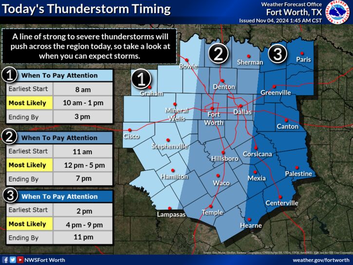
At midday Monday, the National Weather Service issued a hazardous weather outlook for Lampasas, Hamilton, Bell, Coryell and surrounding counties due to severe storm forecasts later in the afternoon.
“Widespread thunderstorms will continue to develop over much of North and Central Texas during the day today,” the statement read. “Severe weather, including damaging winds, tornadoes, and hail will all be possible. The greatest severe threat will materialize generally along/east of I-35 this afternoon and evening.”
After a short reprieve, stormy weather will be possible again later this week, officials said.
“Thunderstorm chances will return to the forecast by Thursday and continue into the weekend,” the outlook read.
According to the NWS daily forecast, Lampasas County will see a 70% chance of thunderstorms Monday afternoon, dropping to 50% overnight. Rainfall amounts of between a tenth and a quarter of an inch may be expected, and higher amounts are possible in thunderstorms. Winds could gust as high as 25 mph.

