
While Friday’s temperature is expected to be hot, hot, hot, storms moving west across Central Texas this weekend may offer Lampasas County some reprieve.
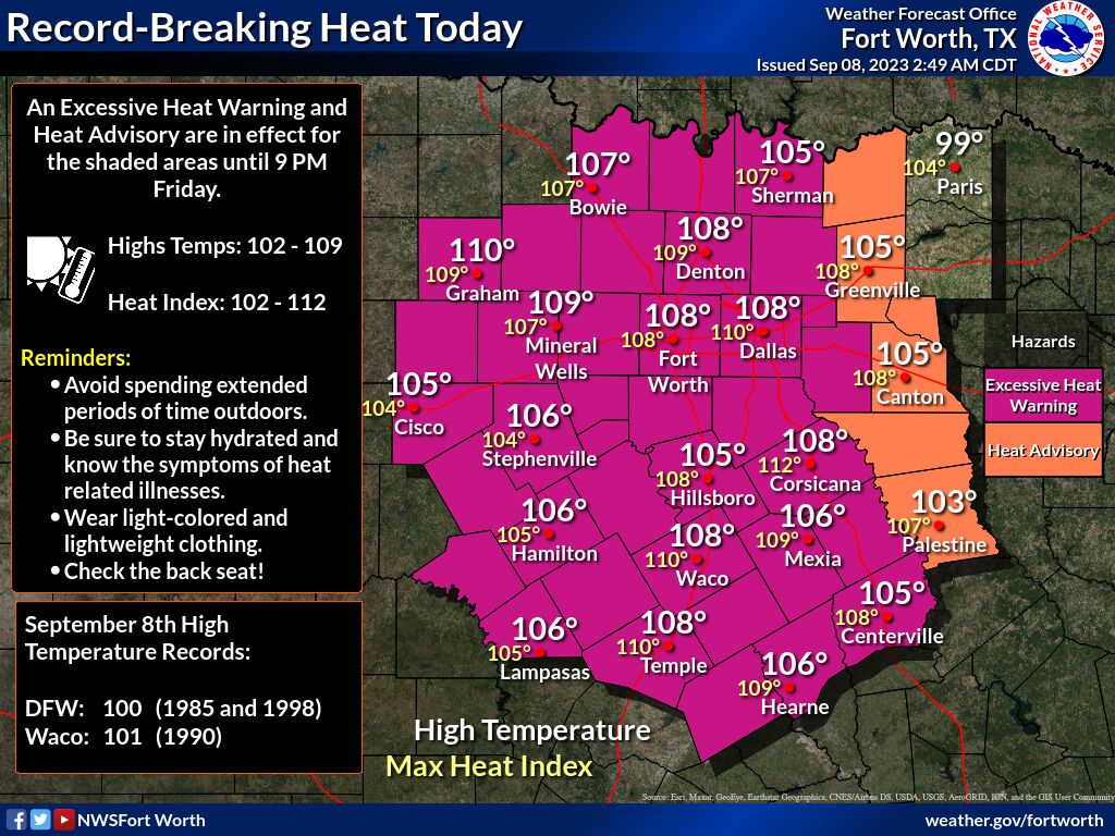
At 4:25 a.m. this morning, the National Weather Service issued an excessive heat warning effective until 9 p.m. Friday for Lampasas, Hamilton, Coryell, Bell and surrounding counties.
NWS meteorologists said dangerously hot conditions with temperatures up to 109 degrees and heat index values up to 112 degrees are expected.
“Extreme heat and humidity will significantly increase the potential for heat-related illnesses, particularly for those working or participating in outdoor activities,” officials said.
In a hazardous weather outlook issued at 3:36 a.m. Friday, NWS meteorologists said thunderstorm activity will move southwest across Central Texas today and will continue throughout next week.
“Storm chances will spread southwestward, closer to the I-35 corridor as we approach sunset,” officials said. “A few storms may be strong to severe, with damaging winds and large hail the main threats. Heat will continue on Saturday for areas west of I-35, where highs are expected to range between 100-105. Storm chances will continue through the rest of the week. Severe storms are not expected.”
For Lampasas County, thunderstorm chances hang at 30% for Saturday and Sunday, with Sunday’s high temperature expected to drop below the triple digits to 98 degrees.
Storm chances remain at 30% for Monday before rising to 50% on Tuesday. High temperatures are anticipated at 95 degrees and 87 degrees, respectively. Both days may see winds of up to 10 to 15 mph, with gusts of up to 20 mph possible.

